C-MAP Reveal Nordwest-Europa (North-West European Coasts) EW-Y227
Description
Electronic nautical chart for the North Sea and English Channel to the French Atlantic for the modern chartplotters and multifunction displays from Simrad B&G and Lowrance.
Coverage
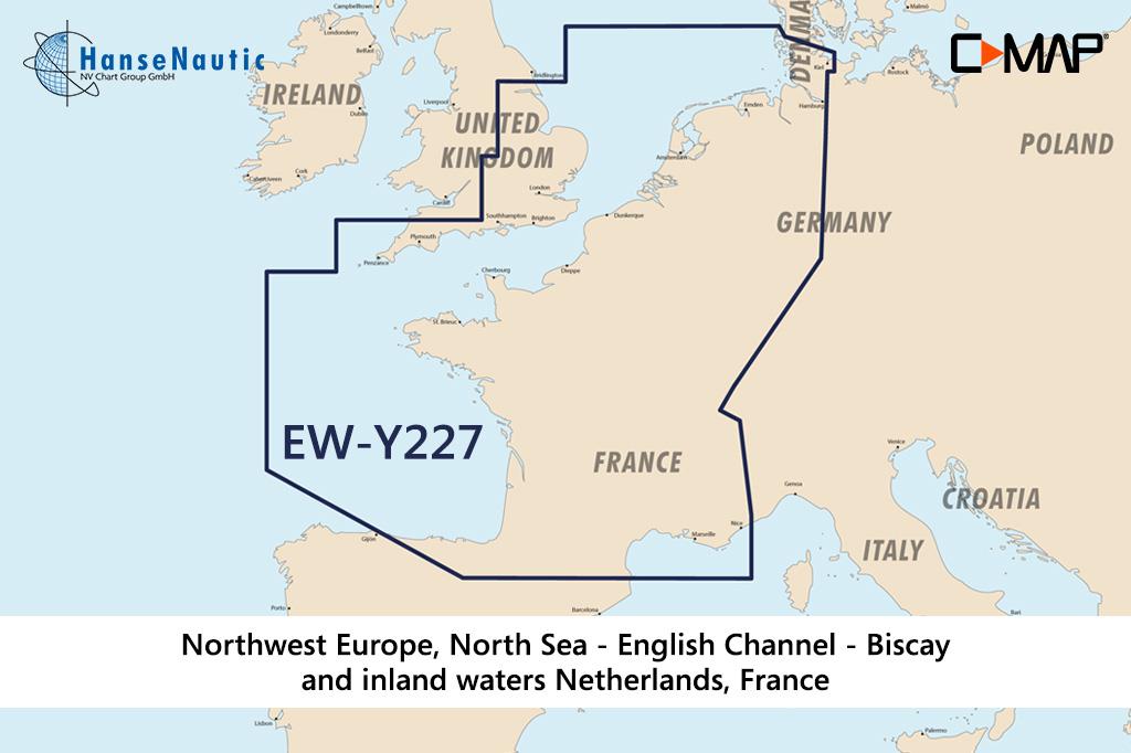
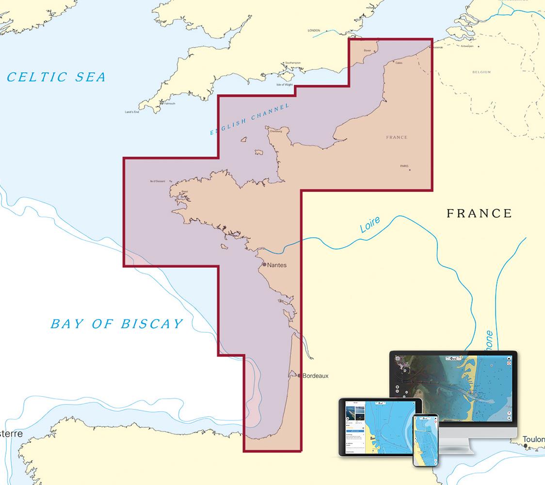
The C-MAP Reveal North-West Europe (North-West European Coasts) EW-Y227 offers a wide coverage for the holiday spots and fishing grounds in Western Europe
The following sea areas are included in this electronic nautical chart:
- German North Sea (German Bight and Wadden Sea
- Netherlands u. Belgium with coastal waters and inland waterways
- The coast of England from the East of England to Cornwall incl. Solent and Thames
- Frances Channel coast (La Manche) and the Channel Islands of Geurnsey Jersey & Co.
- Brittany
- French Atlantic Coast to the Bay of Biscay
- Inland Waters (Canals Rivers) of France
This coverage includes all the areas popular with water sports enthusiasts in the west of Europe and allows long and extensive trips through France along the coasts from the IJsselmeer to the Bay of Biscay with one map. Smaller fishing boats can be flexibly deployed to different fishing spots in the North Sea Channel and Atlantic with this Wide coverage.
Features of the new C-MAP Reveal nautical charts
C-MAP offers with the Reveal products high-quality nautical charts with additional benefits for anglers fishermen and demanding navigators. C-MAP Reveal are premium charts with extra display options of nautical and underwater information!
- Electronic Marine Charts - Vector charts with all nautical information continuous zooming from harbour plan to overview chart
- Easy Routing gives route suggestions based on the nautical chart data and your custom vessel information.
- Tide information includes high and low tide times and current data. A tide calendar and a current atlas are integrated into the chart
- RShadow relief representation of the seabed - Three-dimensional image of the seabed and shore slopes in highest resolution
- ROfficial raster sea charts - Especially for narrow fairways this representation offers known from paper nautical charts provides a better overview of the navigational situation.
- R Satellite images & aerial photographs provide information on the surroundings of an anchorage or harbour.
R Exclusive to C-MAP Reveal!
Disc
This EW-Y227 electronic nautical chart is supplied on an mSD disc which is contained in an SD card adapter.
Compatibility
The C-MAP Reveal France Netherlands is compatible with Simrad B&G and Lowrance modern chartplotters.
Tip: Always state the make and model of your plotter when ordering your nautical chart to avoid incorrect deliveries. You can also check the HanseNautic compatibility list to see whether your chart plotter can process the C-MAP Reveal charts.
Revocation excluded
These nautical charts are produced by us for you on customer request in order to always provide you with the most up-to-date data. For this reason, the charts are excluded from exchange and revocation.
| Format: | mSD-Karte |
|---|---|
| Size: | Wide |
With the help of our area preview, you can get an impression of which geographical region the product deals with or which areas a nautical chart covers.
Products near this article
Reviews
Login

