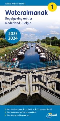
ANWB Wateralmanak 1 2023/2024

€20.90*

% €21.99* (4.96% saved)
 
 
Product number: 34680

Description

Available at the end of March

Mandatory equipment in the Netherlands


The Wateralmanak 1 contains all the legal requirements for the Netherlands and Belgium that must be carried along when sailing there. It is a legal requirement to have one on board when sailing in these waters.

It contains not only the legal regulations for the waterways, but also some practical information and tips for Dutch waters. It is in Dutch, and German explanations for signs and abbreviations are also included.

Note:

The Wateralmanak 1 from the ANWB in the current version is part of the compulsory equipment in the Netherlands.


Additionally we recommend:

The Wateralmanak 2: For details on marinas and moorings, the Wateralmanak 2 is navigationally necessary.
In Dutch, with Dutch character explanation.

Related products to this item

Related products to this item

Gebietsvorschau für ANWB Wateralmanak 2 (Brückenzeiten) öffnen
-12 %
ANWB Wateralmanak 2 (Brückenzeiten)
Wateralmanak 2 Sound signals of the Inland Police (BPR) and the Rhine Police (RPR)This almanac includes the opening hours of all bridges and locks in the Netherlands and Belgium. The&nb

€21.99* €25.00* (12.04% saved)
Gebietsvorschau für NV Charts Nederland NL3 - IJsselmeer & Randmeeren öffnen
NV Charts Nederland NL3 - IJsselmeer & Randmeeren
For a trip through the popular sailing area of the IJsselmeer is the NL3 the right choice. Once you have passed one of the lock gates, nothing stands in the way of an eventful trip. The IJsselmmeer do

Variants from €51.99*
€64.99*
Gebietsvorschau für NV Charts Nederland NL6 - Waterkaart Nederland Noord - Friesland - Arnhem öffnen
NV Charts Nederland NL6 - Waterkaart Nederland Noord - Friesland - Arnhem
Inland water chart NetherlandsFor the northern part of the inland waters of the Netherlands, the NL6 Waterkaart Nederland North a practical and handy travelling companion. Together with the NL7 (Water

€64.99*
Gebietsvorschau für NV Charts Nederland NL2 - Waddenzee öffnen
NV Charts Nederland NL2 - Waddenzee
The NV Atlas NL2 is the ideal chart to explore the Waddenzee region.The chart series, specially designed for recreational boating, contains the nautical charts in various sizes, as well as all harbor

Variants from €58.49*
€64.99*
-20 %
Subscription - NV Charts Nederland NL3 - IJsselmeer & Randmeeren
NV Charts NL3[nvtext_abo_2_jahre]

€51.99* €64.99* (20% saved)

Reviews

0 of 0 reviews

Leave a review!

Share your experiences with other customers.


Gezeitentafeln 2025: Europäische Gewässer
Nautical publication with all tidal information and its forecasts as well as instructions for use for the tidal ranges in Europe. The "Gezeitentafeln 2025: Europäische Gewässer" (Tide Tables for

€28.00*
Gebietsvorschau für Reeds Nautical Almanac 2024 öffnen
Reeds Nautical Almanac 2024
The comprehensive cruising guide for the North Sea, British Isles and European Atlantic coast offers all the information you need in a compact almanac, from passage planning and up-to-date port plans

€59.00*
Gebietsvorschau für Gezeitenstromatlas NP251 North Sea, Southern Part öffnen
Gezeitenstromatlas NP251 North Sea, Southern Part
Tidal streams diagrams include detailed tidal stream direction and strength information. They show at a glance the direction and rate of tidal streams display neap and spring tidal rates in tenths of

€33.90*
Reeds Eastern Almanac 2024
Detailed guide to the east coast of England to the Shetland Islands and the North Sea coast of the Netherlands and Belgium.A great aid for watersports enthusiasts in a handy spiral binding. Extracted

€49.99*
Gebietsvorschau für Törnführer Holland 1 öffnen
Törnführer Holland 1
Revierinformationen für den südlichen Teil der Niederlande mit TörnbeschreibungenDer Törnführer Holland 1 gibt wertvolle nautische Informationen zu den Binnengewässern im Südteil der Niederlande und i

€39.90*
New
Reeds Eastern Almanac 2025
Detailed guide to the east coast of England to the Shetland Islands and the North Sea coast of the Netherlands and Belgium.A great aid for watersports enthusiasts in a handy spiral binding. Extracted

€50.10*
Gebietsvorschau für Törnführer Holland 2 - Das IJsselmeer und die nördlichen Provinzen öffnen
Törnführer Holland 2 - Das IJsselmeer und die nördlichen Provinzen
District information for the IJsselmeer and the northern part of the Netherlands with trip descriptionsThe Trip Guide Holland 2 gives valuable nautical information on the inland waters in the north of

€39.90*
Gebietsvorschau für Nautische Reisetipps Watteninseln Niederlande öffnen
Nautische Reisetipps Watteninseln Niederlande
A practical guide for recreational skippers sailing on their own keel in the Dutch Wadden Sea.Kilimanjaro in Tanzania the Great Barrier Reef in Australia and the Dutch Wadden Sea have at least tw

€19.95*
Gebietsvorschau für Törnführer Nordseeküste 1; Cuxhaven bis Den Helder öffnen
Törnführer Nordseeküste 1; Cuxhaven bis Den Helder
Cuxhaven to Den HelderFrom the Wadden SeaThe sailing guide North Sea Coast 1 is a classic among sailing guides. The book guides you in detail through the regions ports and picks up on regional feature

€39.90*
Tide tables 2024: European waters
Nautical publication with all tidal information and its forecasts as well as instructions for use for the tidal ranges in Europe. The "Gezeitentafeln 2024: Europäische Gewässer" (Tide Tables for

€27.00*
Gebietsvorschau für Nautische Reisetipps Ijsselmeer öffnen
Nautische Reisetipps Ijsselmeer
Aguide to the Ijsselmeer and MarkermeerThe most beautiful harbours for sailors and motorboat driversThe largest lake in the Netherlands attracts thousands of water sports enthusiasts from home and abr

€19.95*
Gebietsvorschau für North Sea Passage Pilot öffnen
North Sea Passage Pilot
Southern North Sea passage guide with passage routes for traversing this challenging tidal area between the English east coast and the west coasts of the Netherlands and Belgium.The North Sea Passage

€43.00*