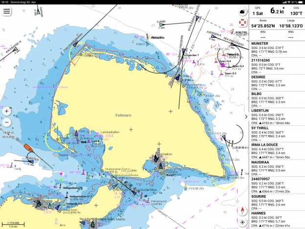
AIS in the NV Charts App
Connect your NV Charts App with a Wlan (Wifi) capable AIS device on board and receive all AIS targets on your mobile device. The NV Charts App displays class A and B vessels, navigation aids (ATON) as well as MOB AIS SART transponder distress transmitters directly in the digital chart in real time. With the display of other AIS positions of ships in the vicinity in real time, the traffic situation can be better assessed. At the same time, the displayed ship name and callsign can also help to establish contact via VHF. When emergency transmitters are displayed, a route to the receiving position is automatically created and the current route is terminated. In a dashboard on the right-hand side of the screen, ships in the vicinity can be observed and the point of closest approach (CPA) is clearly displayed.
To activate the AIS function in the app, only the access data for the AIS router must be saved under Settings > GPS/AIS (IP address and port).
The NV Charts App works with many AIS receivers and was tested with the following devices:
- Actisense’s W2K-1 https://www.actisense.com/product/w2k-1/
- Weatherdock Wifi compatible devices https://www.easyais.com/en/products/ais-receivers/
But this is a standard format and really any AIS receiver sending NMEA 0183 over Wifi TCP-IP (which most do, and this can usually be easily configured) should be compatible.
