
Oosterschelde - important changes to lights and buoys
New Lights and Buoys for the River Schelde
With NV Charts you will always have access to the latest navigation data
In the course of the river Oosterschelde from the port of Stavenisse via Keeten, Mastgat and Zijpe to the village of Bruinisse, the beacons, fairway buoys and orientation landmarks for navigation and water sports have been restructured. These changes are in force since a few days and with the new update service of the NV Charts also in the sport boat chart set NV NL5 Ooster- en Westerschelde available.
Fairway of river Oosterschelde
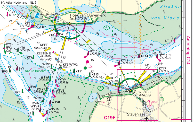 Before
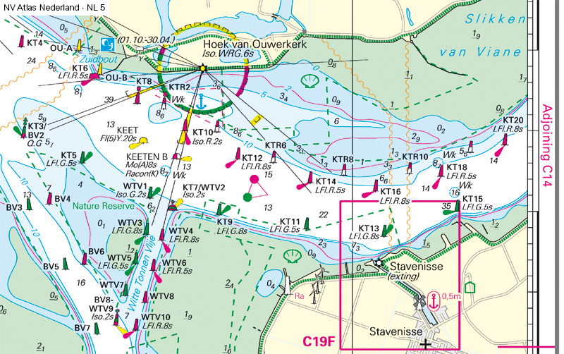 After
After
In the fairway of the Oosterschelde, navigation until September 2021 was
strongly oriented on lighthouses on the shore, which were set up as
leading or cross lights.
From October 2021, individual lighthouses have been decommissioned and
numerous new lateral buoys were laid out. The yachts, ships and motorboats
orient themselves in the future at the red and green fairway buoys to
follow the Oosterschelde.
South Bank of the Oosterschelde
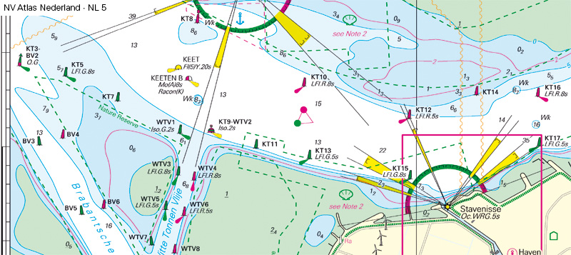 Before
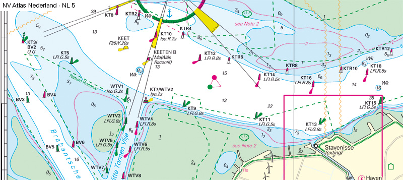 After
After
On the southern bank of the Oosterschelde the lighthouse Stavenisse was in
operation. This cross light was giving orientation for the ships during
darkness.
Since October 2021, the lighthouse is extinguished and as a replacement,
new green buoys have been placed as a boundary to the starboard side. The
position of numerous other navigation marks has been adjusted, so that the
fairway of the Oosterschelde continues to be safely navigable.
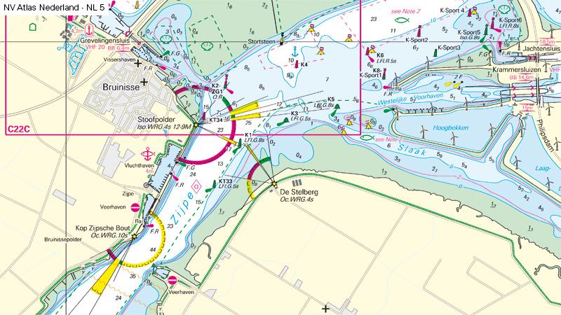
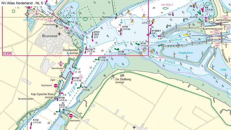
Transition of river Oosterschelde into Greveling Meer
 Vorher
 Nachher
At the transition of the Oosterschelde into the Grevelingen Meer or into
the Volkerak the lighthouse Stoofpolder in the village Bruinisse was in
operation until recently.
The lighthouse Stoofpolder is extinguished from October 2021 and is
replaced by newly deployed lighted buoys in the Oosterschelde. Through the
new beacons, safe navigation in the upper part of the Oosterschelde is
still possible at night.
These changes affect the NV Charts NL4 and NL5.
How can I make use of these corrections in my NV Charts?
For the current series of NV Charts sport boat chart sets for the Netherlands there is a free update service. As soon as you register via the NV Charts app and activate your current nautical chart, you will receive regular updates for navigation with the app on your tablet. In addition, you will receive an email with correction sheets for the chart atlas (paper nautical charts).