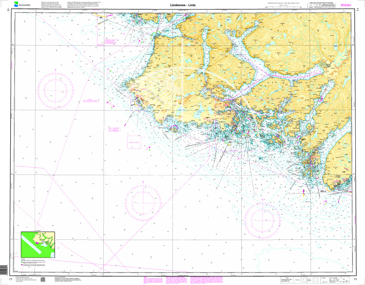
Norwegen N 11 Südnorwegen von Lindesnes nach Lista

Chart ID: NOR 11
Scale: 1:50.000

€27.70*


Product number: 20513

Description

The Map N 11 covers the coastal landscape from Lindesnes in southern Norway to Lista. The detailed scale is 1:50000. For the approach to Farsund Havn we recommend the detailed map N 477. We print this map on customer request from actual data sets of the Norwegian Bureau of Hydrography using the Print-on-Demand (POD) method.

POD charts are excluded from exchange.

The official Norwegian nautical charts are not only suitable for water sports enthusiasts and anglers for navigation but are also very popular with cruise tourists.

For more information on the official Norwegian nautical charts printed by HanseNautic using the print-on-demand (POD) process please click here.

Region: Skagerak, Norwegen
Size: Einzelkarte Papier
Area preview

With the help of our area preview, you can get an impression of which geographical region the product deals with or which areas a nautical chart covers.

Recommended by NV Charts

Related products to this item

Related products to this item

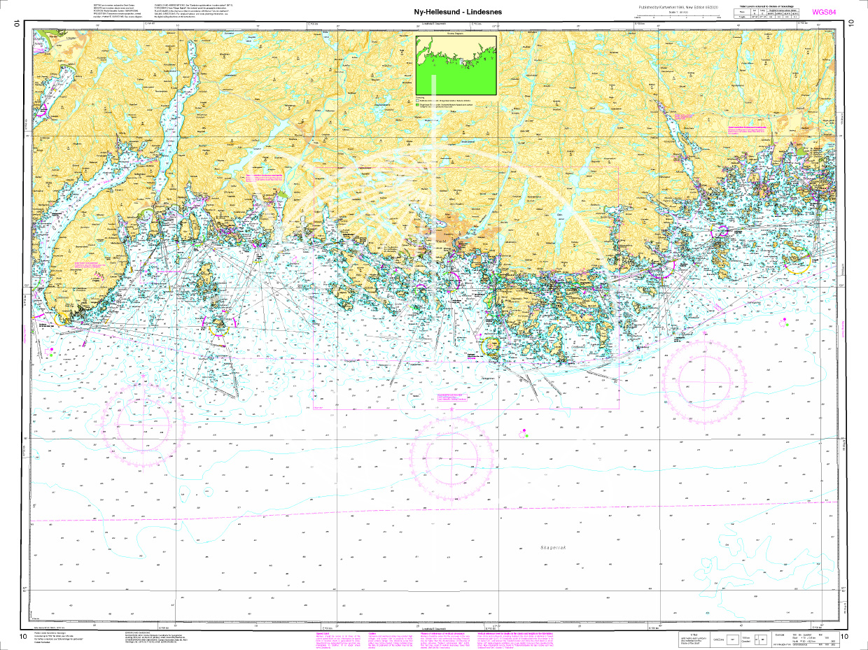
Norwegen N 10 Südnorwegen Ny-Hellesund bis Lindesnes
The Map N 10 covers the south coast of Norway from the island of Ny-Hellesund to the southernmost point of the Norwegian mainland the Lindesnes lighthouse. The detailed scale is 1:

€27.70*

Products near this article

Products near this article

NV Atlas Norway NO4 Sørlandet Vest - Flekkefjord til Kristiansand
If you want to go directly from North Jutland to the southwest coast of Norway, you should have the  NO4 already on board. The southwest coast is the climatically mildest region of Norway and off

€74.99*
NV Atlas Norway NO5 Sørvestlandet Sør - Flekkefjord til Stavanger
The NO5 is a good choice if you have the beautiful fjord world of Norway in mind for your destination. From Lista or rather Flekkefjord, the route follows the rougher coastline to Stavanger. There, th

€74.99*
NV Norwegen Plotterseekarten
Maps & Port plans of the series NO 1 NO 2 NO 3 NO 4 NO 5 & NO6Discover Norway the land of 1000 fjords with plotter sea charts from NV Verlag. All 6 NV Norway sets are included on this map chip m

€129.99*
Norwegen N 477 Farsund Havn mit Ansteuerungen
The chart N 477 covers the waters of Farsund the port of Farsund and the approaches to it through the offshore archipelago. Farsund is located on the southwest coast of Norway west of Mandal. Scale 1:

€27.70*
Norwegen N 478 Ansteuerung Flekkefjord
The map N 478 shows the approach from Listafjord to Flekkefjord harbour. As an additional map set we recommend here NO 11 and NO 12.The detailed scale is 1:20000. As additional map

€27.70*
Norwegen N 12 Südwestküste von Lista bis Svåholmane
The Map N 12 covers the coastal landscape of south-west Norway from Lista to just below Egernsund. The detailed scale is 1:50000. For the approach to Flekkefjord via Listaf

€27.70*
Norwegen N 10 Südnorwegen Ny-Hellesund bis Lindesnes
The Map N 10 covers the south coast of Norway from the island of Ny-Hellesund to the southernmost point of the Norwegian mainland the Lindesnes lighthouse. The detailed scale is 1:

€27.70*
N 457 POD
Mandal havn. - POD cards are excluded from exchange.

€27.70*
N 467 POD
Egersund havn Sirevåg og Hellvik med innseilinger. - POD cards are excluded from exchange.

€27.70*
Norwegen N 13 Südwestküste Egernsund Nesvåg - Kvassheim
The Map N 13 covers the southwest coast of Norway around Egernsund from Nesvåg to the Kvassheim lighthouse. The detailed scale is 1:50000. We print this map on customer req

€27.70*
Norwegen N 132 Südwestküste Stavanger von Høgsfjorden bis Lysefjorden.
The Map N 132 is the map set that takes you from Stavanger to the fjord world from Høgsfjorden to Lysefjorden one of Norways longest fjords.  The detailed scale is 1:50.000.We

€27.70*

Reviews

0 of 0 reviews

Leave a review!

Share your experiences with other customers.