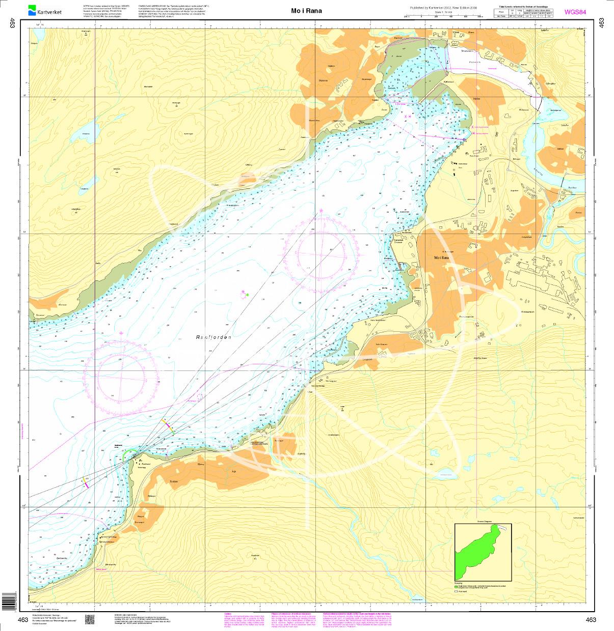
N 463 POD

Chart ID: NOR 463
Scale: 1:10.000

€27.70*


Product number: 20677

Description

Mo i Rana. - POD cards are excluded from exchange.
Area preview

With the help of our area preview, you can get an impression of which geographical region the product deals with or which areas a nautical chart covers.

Products near this article

Products near this article

Norwegen N 60 Atlantik vom Ranfjord
The Map N 60 shows the 68km long Ranfjord from the island of Dønna north-east.The detailed scale is 1:50.000. As an additional map we recommend N 62 (Luroeya - Nesoeya - Roedoe

€27.70*
Norwegen N 135 Atlantik Roedoeya - Stoett
The Map N 135 shows the island groups located near the coast from Roedoeya to Stoett. The detailed scale is 1:50.000. As additional maps we recommend N 63 (Myken - Tern

€27.70*
Norwegen N 136 Atlantik Beiarn - Saltfjorden.
The Map N 136 shows the waterways from Beiarn to Saltfjorden below Bodø.The detailed scale is 1:50.000. As an additional map we recommend N 137 (Skjerstadfjorden - Rognan).&nbs

€27.70*
Norwegen N 62 Atlantik Luroeya - Nesoeya - Roedoeya
The Map N 62 shows the western islands of Luroeya - Nesoeya - Roedoeya. The detailed scale is 1:50.000. As an additional map we recommend N 61 (Træna Nesøya Myken). We print th

€27.70*
Norwegen N 64 Atlantik Støtt - Saltfjorden
The Map N 64 shows the island of Støtt and the outer Saltfjord. The detailed scale is 1:50000. As an additional map we recommend N 136 (Beiarn - Saltfjorden). We print the maps

€27.70*
Norwegen N 476 Bodø Havn
The map N 476 shows the harbour of Bodø home of the worlds strongest maelstrom and capital of Nordland province. The detailed scale is 1:50000. As an additional map we recommend N 137

€27.70*
Norwegen N 65 Atlantik Fleinvær - Bodø - Langegøde
The Map N 65 shows the archipelago-rich islands south to northwest of Bodø. The detailed scale is 1:50000. As an additional map we recommend N 476 (Bodø Havn). We print

€27.70*
Norwegen N 66 Atlantik Landegode - Kjerringoey - Leines
The map N 66 shows the outer archipelago of Landegode - Kjerringoey - Leines which is already opposite southern Lofoten when seen from the mainland.The detailed scale is 1:50000. As an

€27.70*
Norwegen N 59 Atlantik von Dønna bis Lurøya
The map N 59 includes the island groups Dønna to Lurøya off the Norwegian coast. The detailed scale is 1:50000. As an additional map we recommend N 60 (Ranfjorden). We prin

€27.70*
Norwegen N 57 Atlantik Vefsen und Leirfjorden
The Card N 57 covers the northern Norwegian coast from Vefsen and  Leirfjord. The detailed scale is 1:50000. As an additional map we recommend N 56 (Tjøtta - Dønna) We

€27.70*
Norwegen N 137 Atlantik Skjerstadfjorden - Rognan
The map N 137 shows the wind-sheltered Skjerstadfjord near Bodø up to Rognan.The detailed scale is 1:50.000. As an additional map we recommend N 136 (Beiarn - Saltfjorden). We

€27.70*

Reviews

0 of 0 reviews

Leave a review!

Share your experiences with other customers.