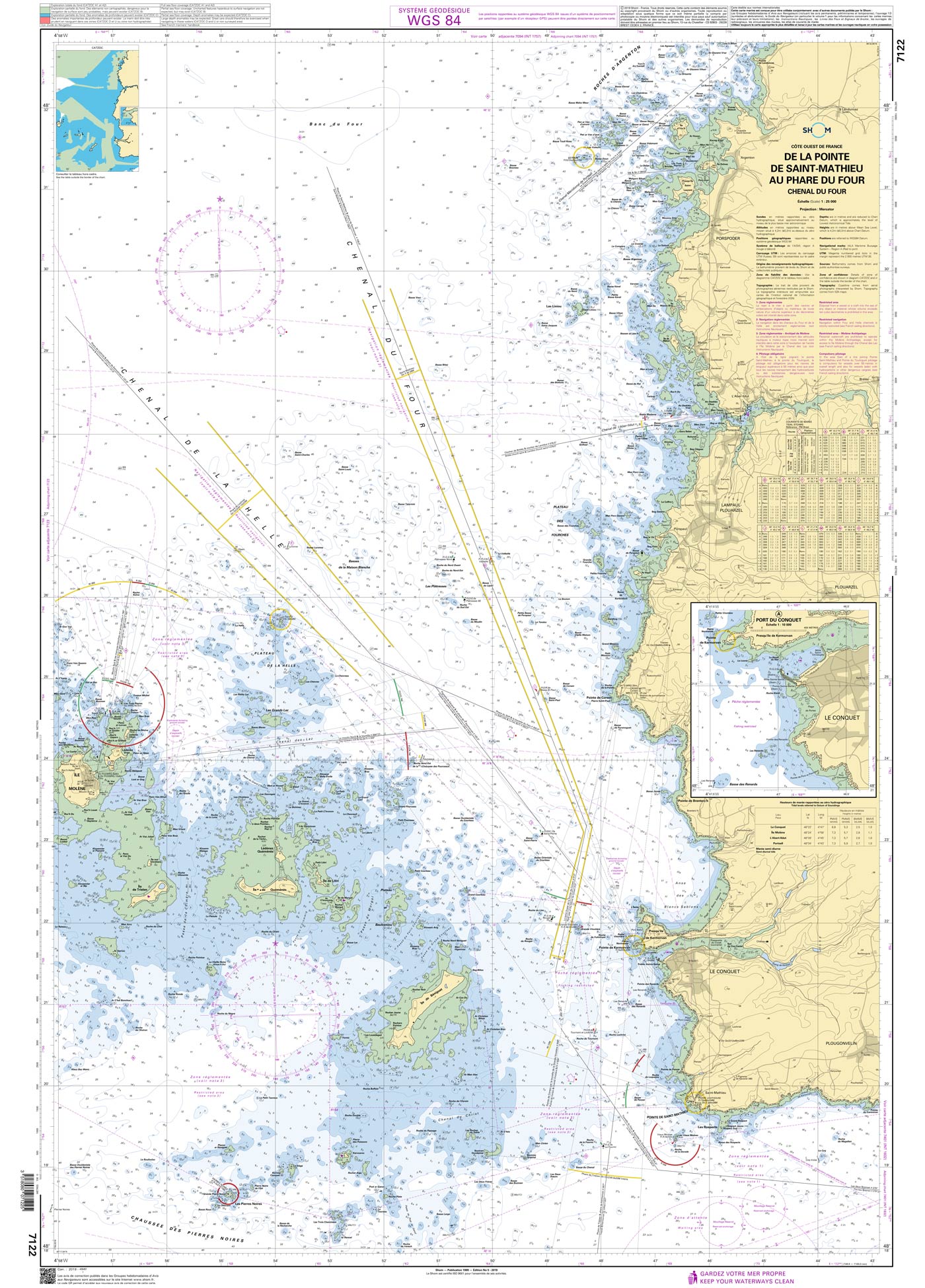
Shom 7122 - De la Pointe de Saint-Mathieu au phare du Four - Chenal du Four

Chart ID: Shom 7122
Edition: Edition n° 5 - 2019 - Dernière correction : 7 - carte marine classique, non pliée, format A0, tirage 2022
Edition Date: 31.01.2017
Scale: 1:25.000

€38.10*

Available (Print on Demand), delivery time 1-3 days


Product number: 20881

Description

The official French chart 7122 from the Shom is a nautical chart for the region De la Pointe de Saint-Mathieu au phare du Four.

The chart contains

  • Scale of 1:25000
  • Stable and water-repellent paper
  • Official French data
  • WGS 84

Chart format

The French nautical charts are printed on customer’s request (print on demand service). This has the advantage that ongoing corrections are taken into account, so the latest version of the Chart is always available.

The charts provide an overview of a specific region. They are well suited for planning a trip. All charts are printed on stable, water-repellent paper. This chart has the following edition information:
Edition n° 5 - 2019 - Dernière correction : 7 - carte marine classique, non pliée, format A0, tirage 2022

Update

The Shom charts are published in new editions irregularly, so the date of correction may be several years ago. You can correct the charts manually with the nautical news.

The Shom

The Shom is a French agency belonging to the country's Ministry of Defence. It is the heir to the world's first official hydrographic service, which dates back to 1720. Shom's portfolio includes almost 900 paper charts. It has its headquarters in the city of Brest in Brittany.

Our recommendation

If you value more up-to-date charts and also digital versions, we recommend the atlases from NV Charts.

Area preview

With the help of our area preview, you can get an impression of which geographical region the product deals with or which areas a nautical chart covers.

Reviews

0 of 0 reviews

Leave a review!

Share your experiences with other customers.


Gebietsvorschau für NV Charts France FR1 - Oostende à Cherbourg öffnen
NV Charts France FR1 - Oostende à Cherbourg
For water sports enthusiasts who want to explore the French canal coast, the NV Charts Atlas FR1 which accompanies you along the coast from Dunkirk (Dunkerque) to Cherbourg. Thanks to the clear layout

€64.99*
Gebietsvorschau für NV Charts Pilot 2, North Sea - Falmouth to Kristiansand - Inverness öffnen
NV Charts Pilot 2, North Sea - Falmouth to Kristiansand - Inverness
NV Charts Pilot 2, North Sea - Falmouth to Kristiansand - InvernessThe Pilot 2 from NV Charts is the planning chart that is needed for the North Sea. The west coast of Denmark, the German North Sea an

€24.99*
Gebietsvorschau für NV Charts England UK2 - Start Point to the Needles öffnen
NV Charts England UK2 - Start Point to the Needles
Anyone longing for a natural, relaxing vacation will be delighted with the NV Charts England UK2 is the best advice. Our charts are based on official data from the United Kingdom Hydrographi

€64.99*
Gebietsvorschau für NV Charts France FR4 - Les Sept Isles à Douarnenez öffnen
NV Charts France FR4 - Les Sept Isles à Douarnenez
The NV Charts France FR4 covers the north-western tip of Brittany. Thanks to the clear layout, the recreational skipper can quickly find approaches, harbours and anchorages and is informed o

€64.99*
Gebietsvorschau für NV Charts France FR2 - Cherbourg à St. Malo öffnen
NV Charts France FR2 - Cherbourg à St. Malo
If you are drawn to the marvellous Channel Islands, the NV Charts Atlas FR2 is well advised! Thanks to the clear layout, the recreational skipper can quickly find approaches, harbours and anchorages a

€64.99*
Gebietsvorschau für NV Charts France FR3 - St. Malo aux Sept Îles öffnen
NV Charts France FR3 - St. Malo aux Sept Îles
Would you like to discover the coast of northern Brittany? Then the NV Charts France FR3 Atlas is your partner at sea. Thanks to the clear layout, the recreational skipper can quickly find a

€64.99*
Gebietsvorschau für NV Charts Engeland UK1 - Scilly Isles to Start Point öffnen
NV Charts Engeland UK1 - Scilly Isles to Start Point
The NV Charts England UK1 will guide you along the fascinating southwest coast of Great Britain . Our charts are based on official data from the United Kingdom Hydrographic Office (UKHO) and include a

€64.99*
Gebietsvorschau für NV Charts England UK3 - The Solent öffnen
NV Charts England UK3 - The Solent
The NV Charts England UK3 Atlas takes you to the strait between Southampton and the Isle of Wight. Our charts are based on official data from the United Kingdom Hydrographic Office (UKHO) and inc

€64.99*
Gebietsvorschau für NV Charts England UK4 - Selsey Bill to London öffnen
NV Charts England UK4 - Selsey Bill to London
The NV Charts England UK4 takes you past the historic North Foreland into the centre of London - or further west along the coast and towns such as Eastbourne and Brighton. Our charts are bas

€64.99*
IMRAY CHART C80
British IslesThis map is a new addition to Imrays C series provides an overview of Great Britain Ireland and neighbouring islands including Orkney Faroe Islands and Shetland.

€34.90*