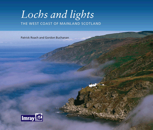
Lochs and lights

Chart ID: IB0171

€14.80*


Product number: 22307

Description

An illustrated book of the west coast of mainland Scotland by Patrick Roach and Gordon Buchanan.


Lochs and Light' is an illustrated book of stunning aerial photographs of the west coast of Scotland, one of the most attractive sailing areas in the British Isles. The tour starts at the mouths of Galloway on the Solway Firth and heads north across the Firth of Clyde, past Ardnamurchan, Oban, Loch Linnhe, Mallaig and past Skye to the lonely and dramatic cliffs of Cape Wrath.


Patrick Roach's superb aerial photographs, taken in typical weather and tidal conditions, are complemented by commentary and description from west coast-based yachting journalist Gordon Buchanan. These marvellous aerial views give a sense of the drama and diversity of Scotland's long and complex coastline. An attractive illustrated book for sailors, walkers and pedestrians alike.

Reviews

0 of 0 reviews

Leave a review!

Share your experiences with other customers.


Gebietsvorschau für CCC Kintyre to Ardnamurchan öffnen
CCC Kintyre to Ardnamurchan
CCC Sailing Directions - Kintyre to Ardnamurchan Das von diesem Führer abgedeckte Gebiet erstreckt sich vom Mull of Kintyre bis zur Halbinsel Ardamurchan und umfasst einige der schönsten Segelgeb

€48.50*
Gebietsvorschau für Reeds Nautical Almanac 2024 öffnen
Reeds Nautical Almanac 2024
The comprehensive cruising guide for the North Sea, British Isles and European Atlantic coast offers all the information you need in a compact almanac, from passage planning and up-to-date port plans

€59.00*
Gebietsvorschau für NV Charts Pilot 6 - US East Coast, Maine to Caribbean • Bermuda öffnen
NV Charts Pilot 6 - US East Coast, Maine to Caribbean • Bermuda
The Pilot 6 is a planning chart for the east coast of the USA. The Antilles, Cuba and the Caribbean Sea can also be found on this chart.This folding chart consists of two overview charts:Chart 1, scal

€24.99*
Gebietsvorschau für NV Charts Atlantic ATL1 - English Channel to Vigo öffnen
NV Charts Atlantic ATL1 - English Channel to Vigo
With the NV Charts Atlantic Atlas ATL1 you have a reliable companion for the Bay of Biscay from Falmouth to Vigo at your side. Thanks to the clear layout, the recreational skipper can quickly find app

€74.99*
Gebietsvorschau für NV Charts Pilot 5 North Atlantic Ocean - Gibraltar to Caribbean, Atlantic Islands öffnen
NV Charts Pilot 5 North Atlantic Ocean - Gibraltar to Caribbean, Atlantic Islands
The NV Charts Pilot 5 is a folding chart that you absolutely need for planning a transatlantic passage. The west coast of Spain, Portugal, Morocco and the Canary Islands are covered in this oversailer

€24.99*
CCC Firth of Clyde
Firth of Clyde covers everything from the busy waters of the Firth of Clyde and River Clyde to the more remote areas of the wider estuary and connected lochs, including the protected and beautiful Kyl

€48.50*
Gebietsvorschau für Crossing the Thames Estuary öffnen
Crossing the Thames Estuary
Crossing the Thames Estuary60 routes covering most passages across the Thames Estuary.The problem with planning passage across the Thames Estuary is that each route consists of a number of different s

€38.20*
Gebietsvorschau für NV Charts Atlantic ATL3 - Atlantic Islands Azores - Madeira, Canary Islands, Cape Verde  öffnen
NV Charts Atlantic ATL3 - Atlantic Islands Azores - Madeira, Canary Islands, Cape Verde
If you want to embark on the great adventure of crossing the Atlantic, the NV Charts Atlantic ATL3 is ideally equipped. Thanks to the clear layout, the recreational skipper can quickly find approaches

€74.99*
Gebietsvorschau für CCC Ardnamurchan to Cape Wrath öffnen
CCC Ardnamurchan to Cape Wrath
CCC Sailing Directions - Ardnamurchan to Cape WrathThe area covered in this guide covers the northern section of the Scottish west coast from Ardnamurchan Point to Cape Wrath, including the whole of S

€48.50*
Gebietsvorschau für NV Charts Atlantic ATL2 - Vigo to Gibraltar öffnen
NV Charts Atlantic ATL2 - Vigo to Gibraltar
With the NV Charts Atlantic Atlas  ATL2 you can navigate reliably from the Spanish Atlantic coast to the Strait of Gibraltar. Thanks to the clear layout, the recreational skipper can quickly

€74.99*
The Cruising Almanac 2025
Detailed cruising guide from the Baltic Sea to GibraltarThe Cruising Almanac, an annual harbour guide, covers most of the varied coasts of NW Europe and includes England, Ireland, Scotland, southern N

€57.90*
Gebietsvorschau für Channel Islands, Cherbourg Peninsula and North Brittany öffnen
Channel Islands, Cherbourg Peninsula and North Brittany
This popular pilotage guide covers the waters of the Channel Islands and the neighbouring French coast from the north-east of the Cherbourg Peninsula westwards along the coast of Normandy and Brittany

€63.50*