Skip to main content Skip to search Skip to main navigation

Product information "Rocks and Rivers"

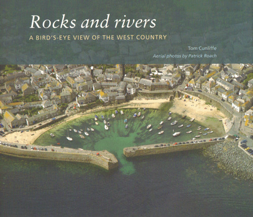
A bird's eye view of the West Country by Tom Cunliffe, photos by Patrick Roach.


England's southern coasts of Devon and Cornwall are the first or last that many sailors see of England. Whether travelling through the Channel, east to London, northern Europe or into the Atlantic, these shores have been a refuge, a guide and occasionally the source of doom.

All of us who have made the crossing or sought refuge in the multitude of harbours between Portland Bill and the Isles of Scilly have only ever seen the coast from the deck. How often have we longed for the wings of a sea eagle to see what we can't see.

Powered flight has finally given us that chance, and Patrick Roach, the maestro of the aerial camera, has excelled so much with this series of images that our mutual friend, the publisher, had little choice but to publish this book. 

Product info:

Author: Tom Cunliffe
Manufacturer: Imray
Details: 250 x 0210mm, Paperback
Edition: 1st edition 2009
ISBN: 9781846231995
Prod. no.: IB0154

0 of 0 reviews

Average rating of 0 out of 5 stars

Leave a review!

Share your experiences with other customers.


Similar products

Gebietsvorschau für CCC Orkney and Shetland Islands including North & Northeast Scotland öffnen
CCC Orkney and Shetland Islands including North & Northeast Scotland
A cruising guide to the Orkney and Shetland Islands which includes Fair Isle. This cruising guide also covers the "jumping off ports" on the south side of the Pentland Firth and the Scottish main

€48.50*
Gezeitentafeln 2025: Europäische Gewässer
Nautical publication with all tidal information and its forecasts as well as instructions for use for the tidal ranges in Europe. The "Gezeitentafeln 2025: Europäische Gewässer" (Tide Tables for

€28.00*
Gebietsvorschau für Gezeitenstromatlas NP251 North Sea, Southern Part öffnen
Gezeitenstromatlas NP251 North Sea, Southern Part
Tidal streams diagrams include detailed tidal stream direction and strength information. They show at a glance the direction and rate of tidal streams display neap and spring tidal rates in tenths of

€33.90*
Reeds Eastern Almanac 2025
Detailed guide to the east coast of England to the Shetland Islands and the North Sea coast of the Netherlands and Belgium.A great aid for watersports enthusiasts in a handy spiral binding. Extracted

€50.10*
Gebietsvorschau für Bloc Marine : Atlantique öffnen
Bloc Marine : Atlantique
The Bloc Marine : AtlantiqueFor accurate information on port areas safety at sea and legal requirements in recreational boating the Bloc Marine Atlantique is a first-class travel companion. It include

€36.00*
Reeds Channel Almanac 2025
Detailed guide to the Channel coastA great help for water sports enthusiasts in a handy spiral binding. Extracted from the large "Reeds Nautical Almanac" with full details - the coverage is limited to

€50.10*
Gebietsvorschau für CCC Ardnamurchan to Cape Wrath öffnen
CCC Ardnamurchan to Cape Wrath
CCC Sailing Directions - Ardnamurchan to Cape WrathThe area covered in this guide covers the northern section of the Scottish west coast from Ardnamurchan Point to Cape Wrath, including the whole of S

€48.50*
Reeds Western Almanac 2025
Detailed guide to the west coast of England and Scotland as well as Ireland, Wales and the Irish Sea to Land's End.A great help for water sports enthusiasts in a handy spiral binding. Extracted from t

€50.10*
Gebietsvorschau für North Sea Passage Pilot öffnen
North Sea Passage Pilot
Southern North Sea passage guide with passage routes for traversing this challenging tidal area between the English east coast and the west coasts of the Netherlands and Belgium.The North Sea Passage

€43.00*
Gebietsvorschau für Gezeitenstromatlas NP218 North Coast of Ireland and West Coast of Scotland öffnen
Gezeitenstromatlas NP218 North Coast of Ireland and West Coast of Scotland
This Tidal Current Atlas for the west coast of Scotland including the Outer and Inner Hebrides and the north coast of Ireland with the transition into the Irish Sea (ADMIRALTY NP218) explains the dire

€33.90*
Bloc Côtier : Atlantique
The "Bloc Côtier" is the reduced version of the "Bloc Marine".In this book, you will find precise information about port areas, safety at sea and legal regulations. It contains port plans and also a s

€24.00*
Gebietsvorschau für Shell Channel Pilot öffnen
Shell Channel Pilot
English Channel Cruising GuideThe "Shell Channel Pilot" cruising guide is suitable for all water sports enthusiasts who wish to explore the English Channel on both the French and English sides. It cov

€50.50*