

BlueChart g3 Chip Regular HXEU002R-S/E England-BeLux Inland
Description
Electronic nautical chart for Garmins modern chartplotters.
The cartography contains integrated chart areas for a transition-free display information on tides and currents. The highly detailed presentation makes the map image very pleasant and complete.
Coverage:
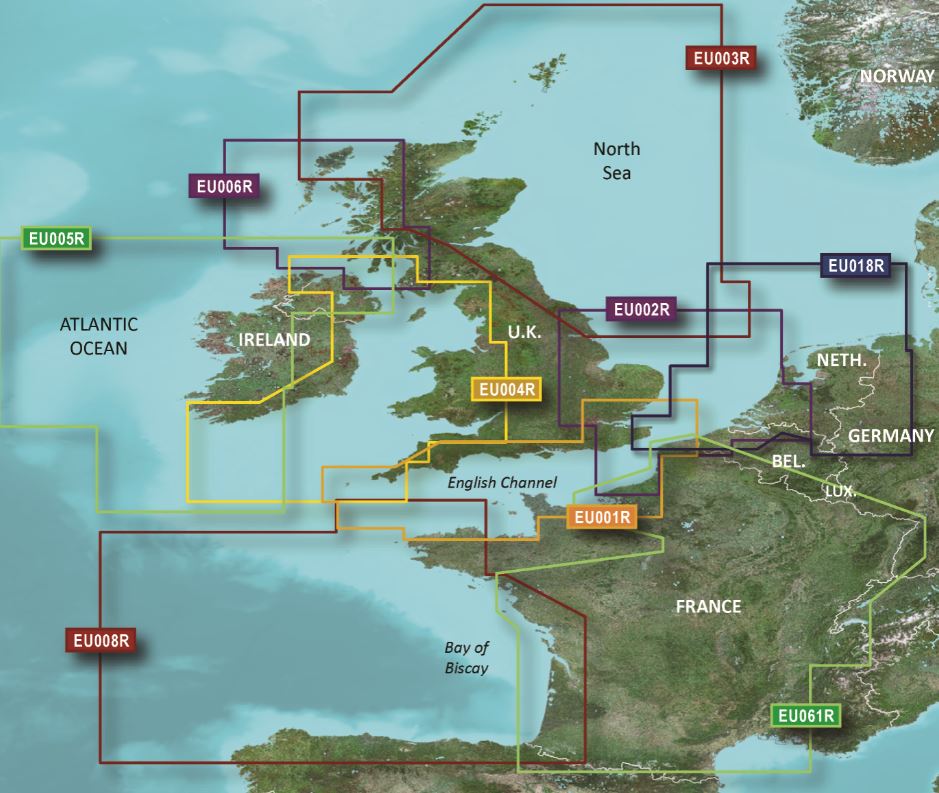
The south-eastern coast of Great Britain incl. North Atlantic as well as some of the most popular inland waterways of Belgium and Luxembourg joining the French and Dutch river and canal network.
Coverage includes the eastern UK coast from Scarborough to Shoreham including the Thames to Teddington the northern European coast from Le Havre FR to Amsterdam NL and numerous inland rivers and canals including the Seine the Somme the Meuse the Oise and the waterway network for Belgium and Luxembourg.
Ports include Goole London Ramsgate and Dover in the UK Rotterdam NL and Antwerp BE and many others.
Please specify your device type.
Media:
Garmin maps are only available on mSD cards. The previously used Garmin modules are no longer available.
As a premium marine chart product g3 charts are available for discerning water sports enthusiasts.
Features:
-Detailed Depth Lines
-Suggested Routes
-Depth Range Shading
-Shallow Water Shading
Compatibility:
Only Garmin charts can be used with Garmin plotters. Other chart manufacturers do not supply suitable charts.
nvtext_bluechart
| Format: | mSD-Karte |
|---|---|
| Size: | Regular |
Reviews
Login