NV Norwegen Plotterseekarten

Edition: 2023
Edition Date: 29.04.2023

€129.99*


Product number: 9842

Description

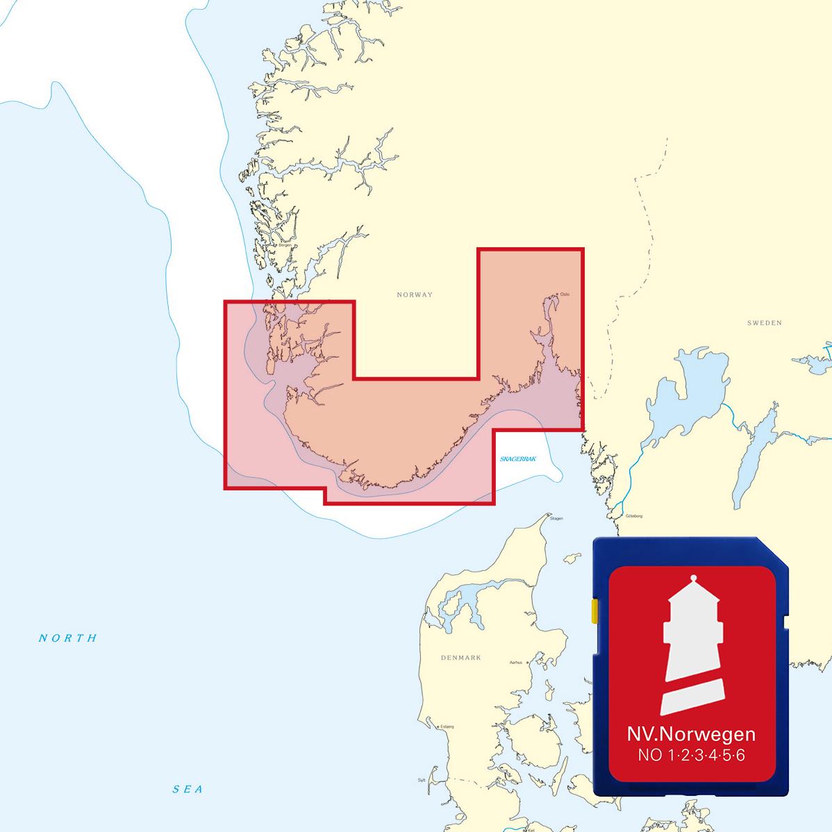
Maps & Port plans of the series NO 1 NO 2 NO 3 NO 4 NO 5 & NO6

Discover Norway the land of 1000 fjords with plotter sea charts from NV Verlag. All 6 NV Norway sets are included on this map chip making it a great addition to the paper nautical charts

The maps are supplied on  "adapter chips" so the appropriate format is included whether your chart plotter uses SD or Micro SD cards.

As the charts are not readable on all devices from Simrad Lowrance and B&G please do not hesitate to contact us if you have any questions.

The SD card or Micro SD contains the digital NV nautical charts of the following series:

  • NO 1 NV. Atlas Norge Oslofjord Nord - Oslo til Tønsberg
  • NO 2 NV. Atlas Norge Oslofjord Sør - Svenska Grensen til Kragerø
  • NO 3 NV. Atlas Norge Oslofjord Øst - Kristiansand til Kragerø
  • NO 4 NV. Atlas Norge Sørlandet Vest - Flekkefjord til Kristiansand
  • NO 5 NV. Atlas Norge Sørlandet Sør - Flekkefjord til Stavanger
  • NO 6 NV. Atlas Norge Sørvestlandet Nord - Stavanger til Haugesund


The nv.plotter charts are stored on SD card and can be used flexibly on the devices according to the Plug & Play principle.
The map image is identical to that of the well-known NV.paper maps. Due to the raster chart display plotters with a screen size of 7 inches or more are recommended.

Features:

Lighthouse sectors are accurately displayed main fairways marked with minimum depths red 2-metre line well-presented and editorially prepared content sheet cut-free chart display.

Please note that NV plotter chips are currently only compatible with Navico Group (Simrad Lowrance B&G) instruments. 

  • Lowrance (All HDS series from Gen.1. & 2 & Elite TI)
  • Simrad (NSE NSS NSO and up)
  • B&G (All units Zeus / Vulcan series and up)


Digital plotter charts are an aid only and do not replace an actual paper chart.

Region: Skagerak, Nordsee
Area preview

With the help of our area preview, you can get an impression of which geographical region the product deals with or which areas a nautical chart covers.

Related products to this item

Related products to this item

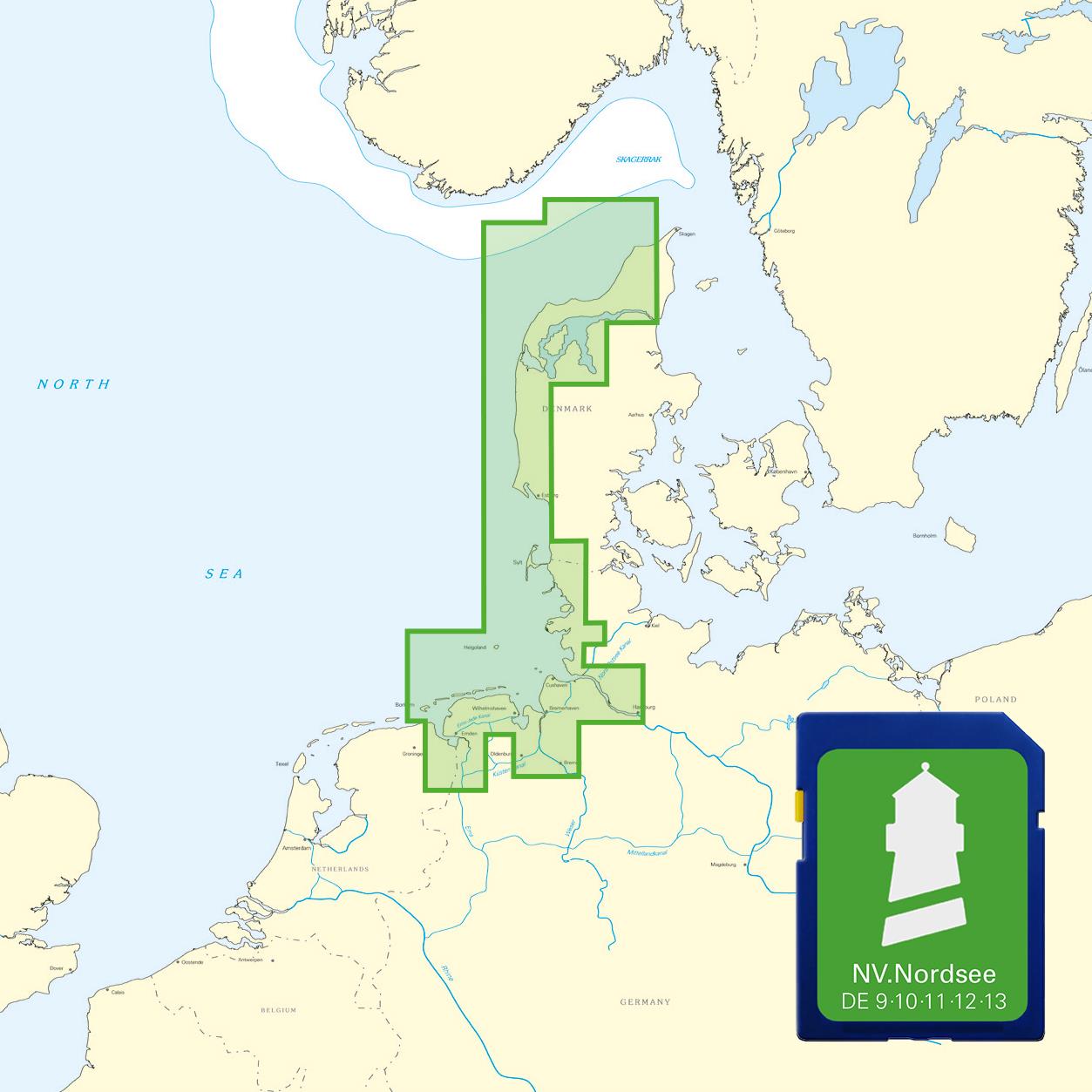
NV Nordsee Plotterseekarten
Maps & Port plans of series 10 11 12 13 and series 9.With this map you can get from Skagen over the Danish west coast to Borkum on the East Frisian Islands. All depth data and the buoyage of

€129.99*

Products near this article

Products near this article

NV Charts Norway NO4 - Sørlandet Vest - Flekkefjord til Kristiansand
If you want to travel from North Jutland directly to the south-west coast of Norway, you should take the NV Charts Norway NO4 on board. The NV Charts for the Norwegian coast are based o

€74.99*
NV Charts Norway NO3 - Sørlandet East - Kragerø to Kristiansand
The NV Charts Norway Atlas NO3 covers the southern coast of Norway up to Kristiansand. NV charts for the Norwegian coast are based on data from the Norwegian Hydrographic Office and also include the h

€74.99*
NV Charts Norway NO5 - Sørvestlandet Sør - Flekkefjord til Stavanger
Your companion for the southwest coast of Norway: The NV Charts Norway NO5 . NV Charts for the Norwegian coast are based on data from the Norwegian Hydrographic Office and also include the h

€74.99*
NV Charts App - Norway
NV Charts App - Norway[nvtext_abo_app_iap]This product can only be used in the NV Charts app, it is not compatible with other navigation programs.

€49.90*
N 459 POD
Kristiansand havn. - POD cards are excluded from exchange.

€27.70*
Norwegen N 9 Südnorwegen von Lillesand, Kristiansand bis Ny-Hellesund
The Map N 9 covers the southern Norwegian coast from Lillesand to the island of Ny-Hellesund incl. Kristiansand in the Skagerrak. The detailed scale is 1:50000. We print this m

€27.00*
Havneguiden 2 Landesund - Lindesnes
The sophisticated south-east coast of the Oslofjord is much easier to conquer when Havneguide 2 is allowed to accompany you.This Norwegian-produced harbour guide introduces you to 293 harbours, anchor

€74.90*
N 457 POD
Mandal havn. - POD cards are excluded from exchange.

€27.70*
ADMIRALTY NP56 Norway Pilot Vol 1
Official ADMIRALTY Sailing Directions for Norway (South Coast)The Skagerrak and the coast of Norway from Egersund/Jaerens Rev to the Norwegian/Swedish border and on to Marstand are covered in detail.

€109.90*
N 451 POD
Grimstad. - POD cards are not exchangeable.

€27.70*
Norwegen N 10 Südnorwegen Ny-Hellesund bis Lindesnes
The Map N 10 covers the south coast of Norway from the island of Ny-Hellesund to the southernmost point of the Norwegian mainland the Lindesnes lighthouse. The detailed scale is 1:

€27.70*

Reviews

0 of 0 reviews

Leave a review!

Share your experiences with other customers.