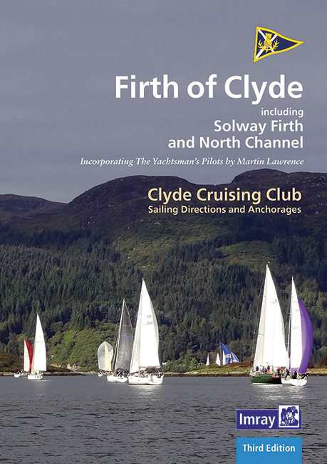
CCC Firth of Clyde

Chart ID: IB0242-1

€48.50*


Product number: 22321

Description

Firth of Clyde covers everything from the busy waters of the Firth of Clyde and River Clyde to the more remote areas of the wider estuary and connected lochs, including the protected and beautiful Kyles of Bute and Loch Riddon, Loch Fyne and the Crinan Canal. Coverage then extends west and south to encompass North Channel and Solway Firth.

This new edition, updated by Geoff Crowley, continues the long-respected legacy of CCC publications for cruising sailors. The North Channel section has been extended to include details for Belfast itself. New photographs throughout illustrate the text and help orientate the navigator. Details on plans have been updated with reference to the new Imray 2900 Firth of Clyde chart pack for the area. References to Bob Bradfield’s useful Antares large scale charts are also included.

Whether you are a local sailor or a first-time cruising visitor, Firth of Clyde is an essential companion in these waters.


‘Drawing upon an impressive list of sources… All charts, photographs and commentary provide unique information for sailors wishing to undertake real or ‘virtual’ cruises in the finest areas of west and northeast Scotland- those of us who have cruised there in the past can only look with envy on all the data, wishing that these fine publications had been available in our day!’ Cruising Magazine


Product information


Author: Clyde Cruising Club/Geoff Crowley
Publisher: Imray
Publication details: A4 150 pp. Soft cover. Spiral bound.
Edition: 3rd
Edition date: 2020
ISBN: 9781786791641
Stock code: IB0242-1

Reviews

0 of 0 reviews

Leave a review!

Share your experiences with other customers.


Gebietsvorschau für NV Charts Bermuda 16.1 - Passages US East Coast - Caribbean - Europe öffnen
NV Charts Bermuda 16.1 - Passages US East Coast - Caribbean - Europe
With the NV Charts Bermuda 16.1 Atlas you have the right companion for the US East Coast - Caribbean - Europe passages at your side. Thanks to the clear layout, you can find accesses, harbours an

€69.80*
Gebietsvorschau für East Coast Rivers Cruising Companion öffnen
East Coast Rivers Cruising Companion
East Coast Rivers covers the rivers creeks shoals and river sections of the Thames Estuary and surrounding rivers stretching from Lowestoft to Ramsgate.Since 1956 when Jack Coote Jans father published

€49.90*
Gebietsvorschau für CCC Orkney and Shetland Islands including North & Northeast Scotland öffnen
CCC Orkney and Shetland Islands including North & Northeast Scotland
A cruising guide to the Orkney and Shetland Islands which includes Fair Isle. This cruising guide also covers the "jumping off ports" on the south side of the Pentland Firth and the Scottish main

€48.50*
Gebietsvorschau für CCC Kintyre to Ardnamurchan öffnen
CCC Kintyre to Ardnamurchan
CCC Sailing Directions - Kintyre to Ardnamurchan Das von diesem Führer abgedeckte Gebiet erstreckt sich vom Mull of Kintyre bis zur Halbinsel Ardamurchan und umfasst einige der schönsten Segelgeb

€48.50*
Lochs and lights
An illustrated book of the west coast of mainland Scotland by Patrick Roach and Gordon Buchanan.Lochs and Light' is an illustrated book of stunning aerial photographs of the west coast of Scotland, on

€14.80*
Gebietsvorschau für East & North Coast of Ireland öffnen
East & North Coast of Ireland
A sailing guide to the north-east coast of IrelandFrom Kilmore Quay and Carnsore Point north via Malin Head to Bloody Foreland. This 13th fully revised edition of the East & North Coasts of Ireland Sa

€48.50*
Gebietsvorschau für NV Charts Pilot 6 - US East Coast, Maine to Caribbean • Bermuda öffnen
NV Charts Pilot 6 - US East Coast, Maine to Caribbean • Bermuda
The Pilot 6 is a planning chart for the east coast of the USA. The Antilles, Cuba and the Caribbean Sea can also be found on this chart.This folding chart consists of two overview charts:Chart 1, scal

€24.99*
Gebietsvorschau für Isles of Scilly öffnen
Isles of Scilly
The Isles of Scilly Cruising Guide The new edition of this comprehensive guide to the Isles of Scilly has been completely revised and updated. Background information on the islands their history and f

€38.20*
Gebietsvorschau für NV Charts Atlantic ATL1 - English Channel to Vigo öffnen
NV Charts Atlantic ATL1 - English Channel to Vigo
With the NV Charts Atlantic Atlas ATL1 you have a reliable companion for the Bay of Biscay from Falmouth to Vigo at your side. Thanks to the clear layout, the recreational skipper can quickly find app

€74.99*
Gebietsvorschau für NV Charts Pilot 5 North Atlantic Ocean - Gibraltar to Caribbean, Atlantic Islands öffnen
NV Charts Pilot 5 North Atlantic Ocean - Gibraltar to Caribbean, Atlantic Islands
The NV Charts Pilot 5 is a folding chart that you absolutely need for planning a transatlantic passage. The west coast of Spain, Portugal, Morocco and the Canary Islands are covered in this oversailer

€24.99*
Gebietsvorschau für Gezeitenstromatlas NP250 The English Channel öffnen
Gezeitenstromatlas NP250 The English Channel
BA NP250 Tidal Stream Atlas: The English ChannelTidal streams diagrams include detailed tidal stream direction and strength information. They show at a glance the direction and rate of tidal streams d

€33.90*
Gebietsvorschau für Irish Sea Pilot öffnen
Irish Sea Pilot
A Territorial Guide to the Irish Sea: Wales North Wales South England Ireland North Ireland South and Isle of ManTheIrish Sea is a vast almost landlocked sea. Around its shores and islands are no fewe

€43.00*