ADMIRALTY NP27 Channel Pilot - Seehandbuch
Description
Official ADMIRALTY Sailing Directions for the English Channel
The coastal sections of the English Channel from Great Britain (Isles of Scilly and South Coast of England from Cape Cornwall to Bognor Regis) and Northern France (Pointe de Penmarch to Cap dAntifer) as well as the Channel Islands of Geurnsey Jersey and Sark are covered in detail. NP27 is part of the world-wide series of books published by the United Kingdom Hydrographic Office (UKHO). They comply with the SOLAS equipment regulations for commercial shipping. In English with numerous photographs maps sketches and illustrations. 2018 12th edition.
Contents
The ADMIRALTY Sailing Direction Channel Pilots (NP27) provide the following topics in detail for the English Channel area:
- Navigation Routes Routes and Traffic Management Areas (TSS)
- Port Facilities Quay facilities and berthing information
- Instructions for port entrances
- Nautical hazard information
- Betonning and approaches
- Climatic background information
Geographical coverage
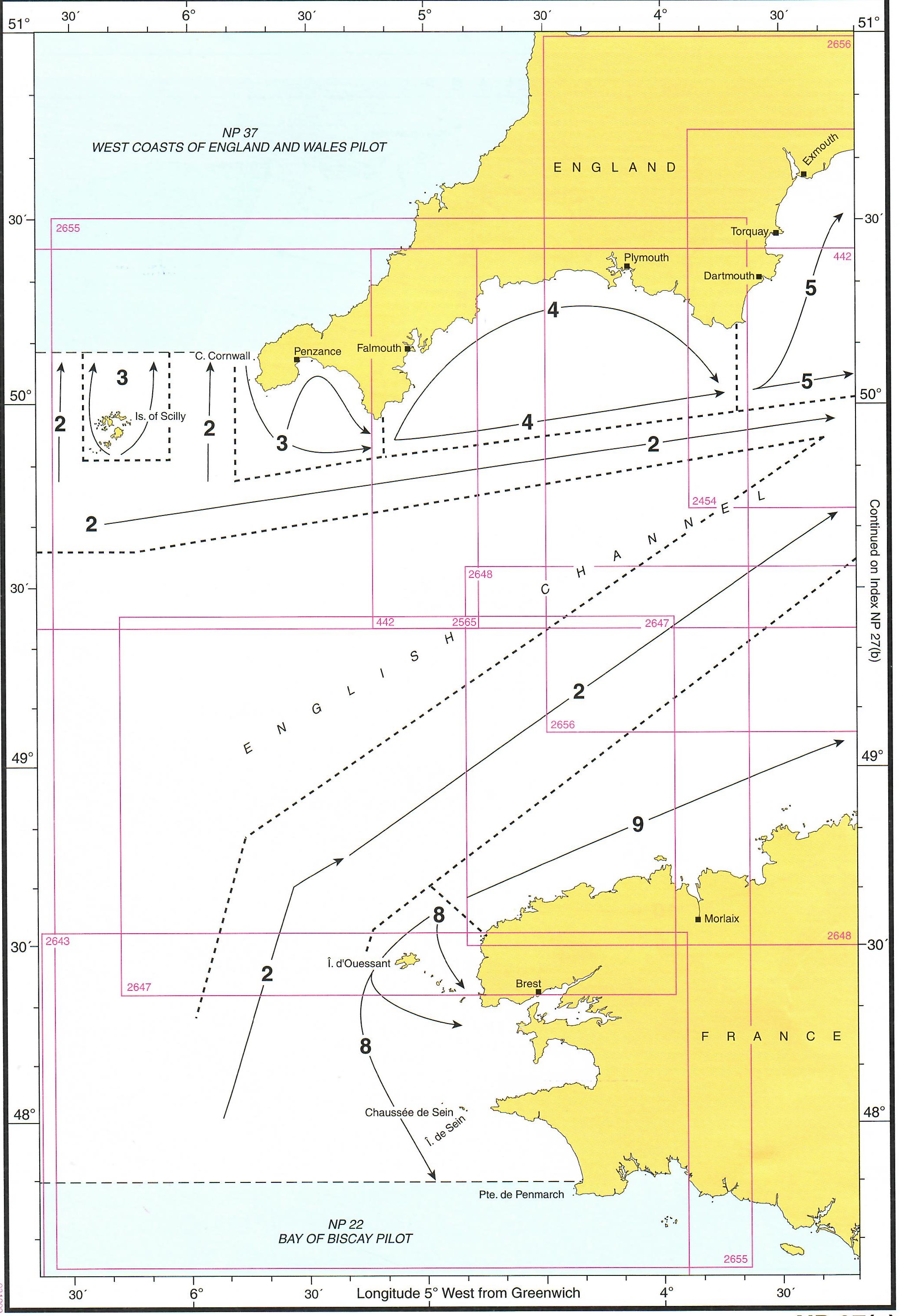
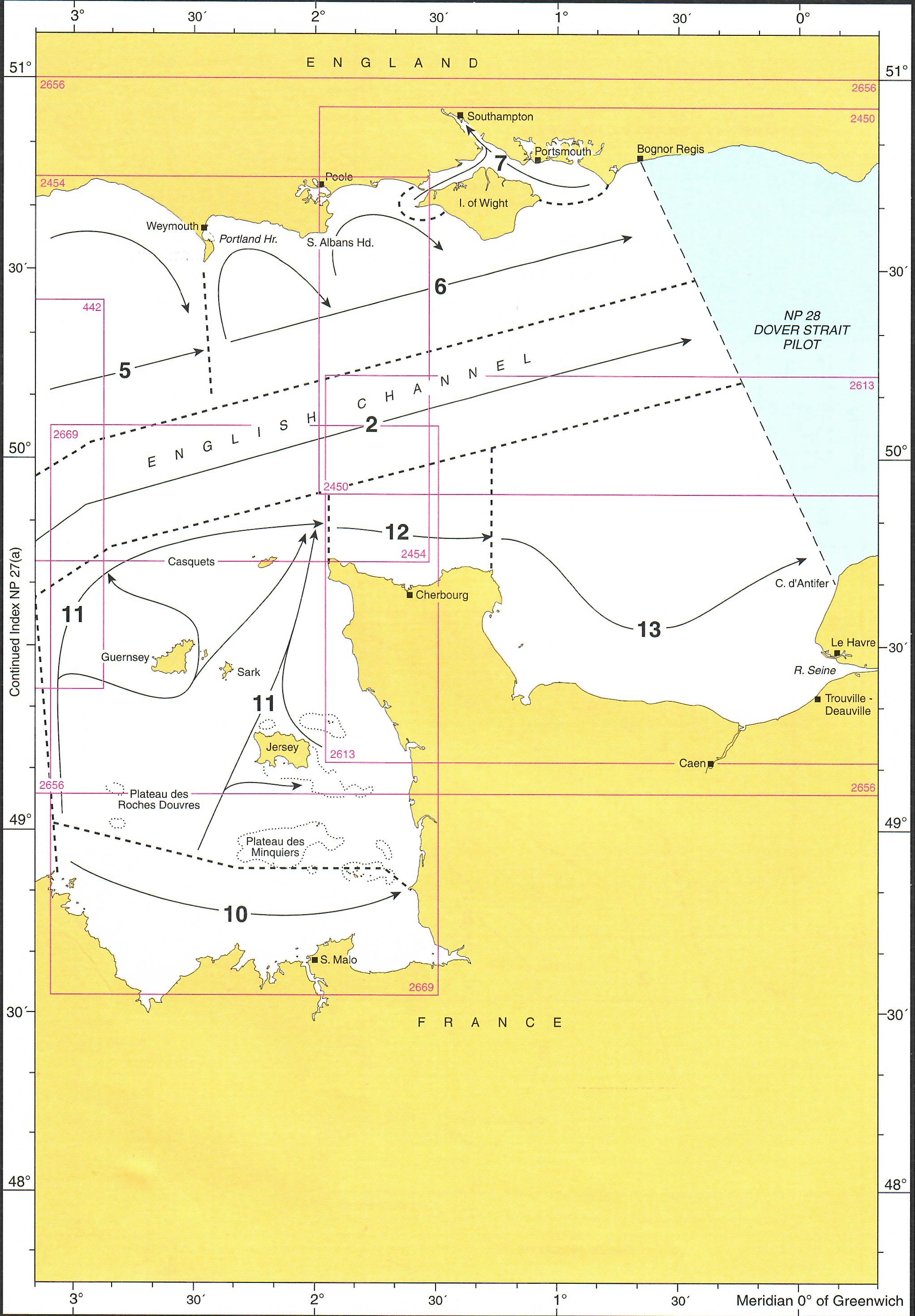
The maritime area is divided into twelve sections along the coasts. (See graphic). It includes
- English Channel for through traffic
- Isles of Scily to Lizard Point
- Cornwall from Lizard Point to Start Point
- South Coast of England from Start Pt. to Bill of Portland
- as well as from Bill of Portland to Bognor
- Solent and Approaches
- Northwest France with the Breton coast from Le Four to Point de la Torche
- Breton coast (North France) from Le Four to Les Héaux-de-Bréhat
- French coast of North Brittany from Les Héaux-de-Bréhat to Granville
- Canal Islands and adjacent coast
- Normandy / French north coast from Cap de la Hague to Point de Barfleur
- French north coast from Pointe de Barfleur to Cap dAntifer
ADMIRALTY Sailing Directions for SOLAS equipment-required shipping
UK Sailing Directions are part of the bridge equipment required on board merchant ships under SOLAS. Depending on the rules of the flag state the necessary official publications and sea manuals must also be on board in addition to the current nautical charts.
ADMIRALTY Sailing Directions are also a useful piece of equipment for navigation on board in non-equipped recreational shipping. Especially in areas where coverage with cruising guides is not possible or not in up-to-date form many skippers resort to the sea manuals.
Numerous illustrations colour photos and sketches facilitate navigation.
Updating the ADMIRALTY Sailing Directions
For the United Kingdom Hydrographic Offices sea manuals the publishers provide free weekly updates on the homepage. These are published as part of the Notice to Mariners. You can also order a subscription for a weekly delivery of the paper version of the Notice to Mariners from your chart suppliers HanseNautic. Feel free to contact us.
With the help of our area preview, you can get an impression of which geographical region the product deals with or which areas a nautical chart covers.
Related products to this item
Reviews
Login

