Skip to main content Skip to search Skip to main navigation

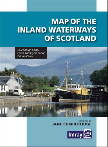
Caledonian Canal Forth & Clyde Canal Crinan Canal. Folding map with general and detailed plans in different scales. Brief descriptions in English. 2013.

The second edition of Imrays Map of the Inland Waterways of Scotland has been updated. Contact details for the new Scottish Waterways Body replacing British Waterways have been added. The descriptive text has been improved by the addition of more photographs.

Imray are synonymous with nautical charts...... and Jane Cumberlidge is a highly respected author on canals throughout Europe. Together they make a formidable pairing and this excellent map reflects all their knowledge and skill. The map is perhaps somewhat of a misnomer as a comprehensive text is provided with excellent accompanying photographs of the Caledonian Crinan Forth & Clyde and Union canals. This second edition has been brought up to date with contact details for Scottish Canals the new body taken over by British Waterways Scotland last July." Keith Goss Waterways World July 2013

0 of 0 reviews

Average rating of 0 out of 5 stars

Leave a review!

Share your experiences with other customers.


Area preview

With the help of our area preview, you can get an impression of which geographical region the product deals with or which areas a nautical chart covers.

Related products to this item

Gebietsvorschau für NV Charts Pilot 2, North Sea - Falmouth to Kristiansand - Inverness öffnen
NV Charts Pilot 2, North Sea - Falmouth to Kristiansand - Inverness
NV Charts Pilot 2, North Sea - Falmouth to Kristiansand - InvernessThe Pilot 2 from NV Charts is the planning chart that is needed for the North Sea. The west coast of Denmark, the German North Sea an

€24.99*

Similar products

Gebietsvorschau für CCC Orkney and Shetland Islands including North & Northeast Scotland öffnen
CCC Orkney and Shetland Islands including North & Northeast Scotland
A cruising guide to the Orkney and Shetland Islands which includes Fair Isle. This cruising guide also covers the "jumping off ports" on the south side of the Pentland Firth and the Scottish main

€48.50*
Gebietsvorschau für CCC Kintyre to Ardnamurchan öffnen
CCC Kintyre to Ardnamurchan
CCC Sailing Directions - Kintyre to Ardnamurchan Das von diesem Führer abgedeckte Gebiet erstreckt sich vom Mull of Kintyre bis zur Halbinsel Ardamurchan und umfasst einige der schönsten Segelgeb

€48.50*
Gebietsvorschau für East & North Coast of Ireland öffnen
East & North Coast of Ireland
A sailing guide to the north-east coast of IrelandFrom Kilmore Quay and Carnsore Point north via Malin Head to Bloody Foreland. This 13th fully revised edition of the East & North Coasts of Ireland Sa

€48.50*
Gebietsvorschau für Isles of Scilly öffnen
Isles of Scilly
The Isles of Scilly Cruising Guide The new edition of this comprehensive guide to the Isles of Scilly has been completely revised and updated. Background information on the islands their history and f

€44.90*
Gebietsvorschau für Irish Sea Pilot öffnen
Irish Sea Pilot
A Territorial Guide to the Irish Sea: Wales North Wales South England Ireland North Ireland South and Isle of ManTheIrish Sea is a vast almost landlocked sea. Around its shores and islands are no fewe

€43.00*
Reeds Channel Almanac 2025
Detailed guide to the Channel coastA great help for water sports enthusiasts in a handy spiral binding. Extracted from the large "Reeds Nautical Almanac" with full details - the coverage is limited to

€50.10*
Gebietsvorschau für CCC Ardnamurchan to Cape Wrath öffnen
CCC Ardnamurchan to Cape Wrath
CCC Sailing Directions - Ardnamurchan to Cape WrathThe area covered in this guide covers the northern section of the Scottish west coast from Ardnamurchan Point to Cape Wrath, including the whole of S

€48.50*
-13 %
The Cruising Almanac 2025
Detailed cruising guide from the Baltic Sea to GibraltarThe Cruising Almanac, an annual harbour guide, covers most of the varied coasts of NW Europe and includes England, Ireland, Scotland, southern N

€49.90* €57.90* (13.82% saved)
Reeds Western Almanac 2025
Detailed guide to the west coast of England and Scotland as well as Ireland, Wales and the Irish Sea to Land's End.A great help for water sports enthusiasts in a handy spiral binding. Extracted from t

€50.10*
Gebietsvorschau für Channel Islands, Cherbourg Peninsula and North Brittany öffnen
Channel Islands, Cherbourg Peninsula and North Brittany
This popular pilotage guide covers the waters of the Channel Islands and the neighbouring French coast from the north-east of the Cherbourg Peninsula westwards along the coast of Normandy and Brittany

€63.50*
Gebietsvorschau für South & West Coast of Ireland öffnen
South & West Coast of Ireland
South and West Coast of IrelandThis 15th edition brings Sailing Directions up to date.It describes the latest developments in infrastructure shipyards new marinas or pontoon mooring facilities in ten

€48.50*
Gebietsvorschau für UK and Ireland Circumnavigator's Guide öffnen
UK and Ireland Circumnavigator's Guide
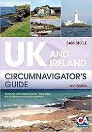
UK and Ireland Circumnavigators GuideA circumnavigation of the UK and IrelandA circumnavigation of the UK and Ireland is the perfect challenge for leisure sailors looking for an extended cruise that w

€32.50*